Braye du Valle
Braye du Valle , St Sampson, Guernsey, GY3
The Braye du Valle is the area between the main Island of Guernsey and Le Clos du Valle, which was a tidal island to the north.
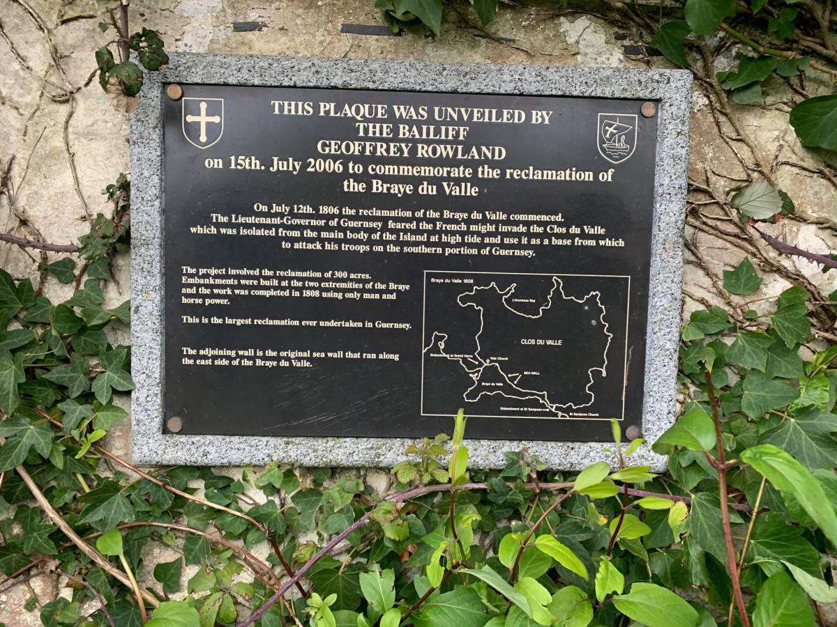
Until 1806, Guernsey was actually 2 islands - with the Braye du Valle estuary separating the Clos du Valle from the rest of Guernsey. Following the French invasion of Jersey in 1781, Guernsey’s defences were strengthened to make sure the same didn’t happen there. Eventually in 1806, Lieut. Governor John Doyle decided to drain the Braye to make sure British troops and artillery could be rushed to L’Ancresse in the event of a French landing. [There is a common misconception that the Braye was filled in, evidence shows that the the area was drained]
Prior to being filled in the Braye du Valle, at low tide, consisted of about 350 acres of sand, gravel, clay and bogs, with channels of water one or two feet deep running along its entire length.
There were also areas called salterns, marshy meadows flooded at high tide, and the salt content of the grass made good grazing for cattle.
The only way to cross was via two small bridges by the Vale Church - Pont St Michel and Pont Allaire - three causeways and the main bridge at St Sampson's - the Pont du Valle.
At high tide, the area of sea was about one mile long by just less than half-a-mile wide. Different accounts put its depth from 10 to 30ft but it was believed that there was enough water for the greatest ships in England to sail.
There is little to indicate that that Guernsey was once split in two. However if you look a little closer there are still some small signs
1. The survival of the name Saltpans - This is where Daniel Hardy and Abraham Le Mesurier made their living capturing sea salt and they were paid for the loss of their livelihood caused by the reclamation.
2. The Vale pond, next to the Vale church is the only remnant of the original water way. Now a the Colin McCathie Nature Reserve.
3. On the northern side of the Braye a length of sea wall made of boulders with rings to tie boats up to can still be found. It is now a listed monument and a path has been made along it to link Braye Road with Folie Lane, a green lane. A plaque was unveiled on 15 July 2006, on the 200th anniversary to commemorate the vision of Sir John Doyle as well as the engineering skills.[
4. Nocq road is the location of the “nocq” or sluice at St Sampson’s
